The geotechnical contrast between a Bellefeuille hillside lot and a flat parcel near the old Dubois industrial sector in Saint-Jérôme can be stark: one sits on shallow Canadian Shield gneiss barely two metres down, while the other overlies thirty metres of Champlain Sea clay laced with erratic boulders. Guessing that boundary with a drill rig alone is expensive and slow. Seismic tomography, both refraction and reflection, lets us draw a continuous velocity cross-section across the entire site in a single day of fieldwork, revealing exactly where rockhead rises, where buried channels cut through the overburden, and where the clay-to-till transition occurs. For Saint-Jérôme projects governed by the NBCC 2020 and CSA A23.3, that kind of coverage turns a handful of borehole points into a validated ground model. When we need to confirm the seismic velocities against direct penetration resistance, the SPT drilling program is laid out using the tomographic profile so every borehole targets a specific velocity anomaly instead of being spaced on a blind grid.
A seismic tomogram converts a few borehole points into a continuous image of the subsurface, cutting the risk of undetected soft zones or pinnacled rock by an order of magnitude.
Process and scope
Site-specific factors
The Rivière du Nord valley experiences a freeze-thaw cycle that penetrates up to 1.5 metres into the overburden, and spring snowmelt saturates the upper clay crust just as construction season begins. Running a seismic survey in late March with frozen ground still present will produce artificially high near-surface velocities, masking the true low-velocity soft clay that governs settlement. We schedule Saint-Jérôme campaigns from late April through October, calibrating the first-arrival picks against soil temperature logs so the inversion accounts for the seasonal velocity shift. The other local hazard is buried esker deposits: pockets of clean sand and gravel left by glacial meltwater channels that can daylight as unexpected flowing ground during excavation. Reflection tomography is particularly effective at spotting these features because the sand-clay contact produces a strong acoustic impedance contrast, visible as a continuous reflector even where boreholes miss it entirely. A single undetected esker lens beneath a spread footing on the east side of Boulevard du Curé-Labelle can trigger differential settlement that cracks blockwork within the first two winters.
Reference standards
NBCC 2020 – Seismic site classification using Vs30 from S-wave tomography, CSA A23.3-14 – Concrete design and exposure classes linked to subsurface conditions, ASTM D5777-18 – Standard guide for seismic refraction profiling, ASTM D7128-18 – Standard guide for surface-wave methods (MASW, complementary to tomography)
Other technical services
Combined refraction and MASW campaigns
We deploy a single geophone spread to capture both refraction first-arrivals and surface-wave dispersion, delivering a Vs30 profile for NBCC site classification alongside a bedrock contour map in one mobilisation.
Rippability and excavatability assessments
Seismic velocity is directly correlated to rock mass rippability per Caterpillar D9/D10 performance charts. We map the rippable-to-blastable transition across the site so earthwork contractors in Saint-Jérôme can bid with accurate quantities.
Typical parameters
Frequently asked questions
How much does a seismic tomography survey cost for a typical commercial lot in Saint-Jérôme?
For a standard commercial parcel requiring 4 to 6 refraction lines with 48-channel recording, budgets in Saint-Jérôme typically fall between CA$4,080 and CA$6,250. The final figure depends on line length, required depth of investigation, terrain accessibility along the Rivière du Nord corridor, and whether S-wave or reflection components are added.
Can seismic tomography tell the difference between hard till and true bedrock?
Yes, that distinction is one of the main reasons we deploy tomography in the Saint-Jérôme area. Compact basal till typically yields P-wave velocities between 1800 and 2400 m/s, while competent gneiss of the Grenville Province reads above 3500 m/s. The velocity gradient across the till-rock contact is sharp enough to map on a tomogram, preventing the common mistake of logging a boulder or till refusal as bedrock.
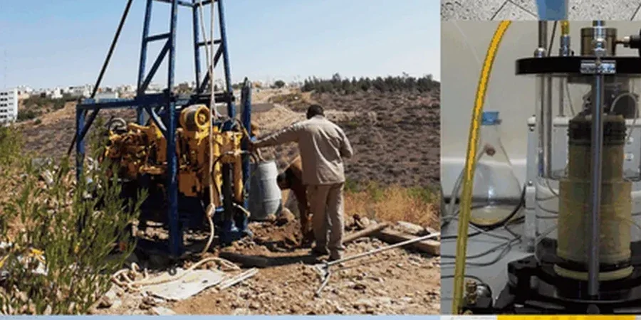
Do you need a borehole to calibrate the seismic results?
The reference range for this service in Saint-Jerome is CA$4.080 - CA$6.250. The final price depends on the project scope and volume.
What permits or approvals are needed for a seismic survey in Saint-Jérôme?
Surface seismic surveys using sledgehammer or weight-drop sources are classified as non-invasive and do not require an environmental or explosives permit in Quebec. For work within the municipal right-of-way along roads like Boulevard du Curé-Labelle, we coordinate traffic management and obtain a temporary occupancy permit from the Ville de Saint-Jérôme. No subsurface disturbance occurs, so the regulatory footprint is minimal.