In Saint-Jérôme, the interaction between glacial till and the alluvial deposits of the Rivière du Nord creates grain size distributions that shift drastically within a single site, and missing that transition can compromise an entire foundation design. We routinely encounter lacustrine silts and sensitive clays at depths starting around 2 meters, particularly on the east side of the Autoroute des Laurentides corridor, where a simple sieve analysis alone will miss the fraction passing the No. 200 that controls drainage and frost susceptibility. To define a representative particle size curve we run the full combined method — mechanical sieving for the coarse fraction and hydrometer sedimentation for fines — aligned with the current CSA A23.3 and ASTM D422 framework. When the grain size results point to poorly graded material with high void ratios, we link the data directly with a test pit program to verify stratigraphy visually, because no lab curve can substitute for what the pit wall reveals about interbedding. The population of Saint-Jérôme has crossed 80,000 and new subdivisions press against the old Champlain Sea limits, where fine-grained deposits demand hydrometer precision to confirm frost-heave potential and drainage class.
A grain size curve that stops at the No. 200 sieve tells you half the story — in Saint-Jérôme’s Champlain Sea clays, the hydrometer fraction is where the real engineering decisions live.
Process and scope
Site-specific factors
The National Building Code of Canada references grain size distribution as a primary input for seismic site classification under Article 4.1.8.4, and in Saint-Jérôme — situated within the Western Quebec Seismic Zone — this is not a paperwork exercise. A site with soft fine-grained soil and a shear wave velocity below 180 m/s can escalate from Site Class D to Site Class E purely on the basis of fines content and plasticity, directly increasing the design spectral acceleration values and foundation costs. We have seen projects in Saint-Jérôme where a preliminary sieve-only report classified a silty sand as granular fill, but the hydrometer re-run exposed 25 percent clay, triggering a seismic response amplification that the structural engineer had not initially accounted for. Under Quebec’s frost action requirements, grain size also determines the Frost Susceptibility Index (FSSI) — silts with high capillary rise potential are the most problematic, and Saint-Jérôme’s winter ground can penetrate 1.6 meters of frost depth depending on snow cover. Omitting the hydrometer on a material that straddles the silt-clay boundary is a classification error that propagates into drainage design, pavement structure, and foundation insulation specifications.
Watch the video
Reference standards
ASTM D422 – Standard Test Method for Particle-Size Analysis of Soils (hydrometer), ASTM D7928 – Standard Test Method for Particle-Size Distribution of Fine-Grained Soils Using the Sedimentation (Hydrometer) Analysis, CSA A23.3 – Design of Concrete Structures (aggregate gradation requirements), NBCC 2020 – Article 4.1.8.4: Site classification for seismic response based on soil properties, BNQ 2501-025 – Quebec standard for granular materials in road construction
Other technical services
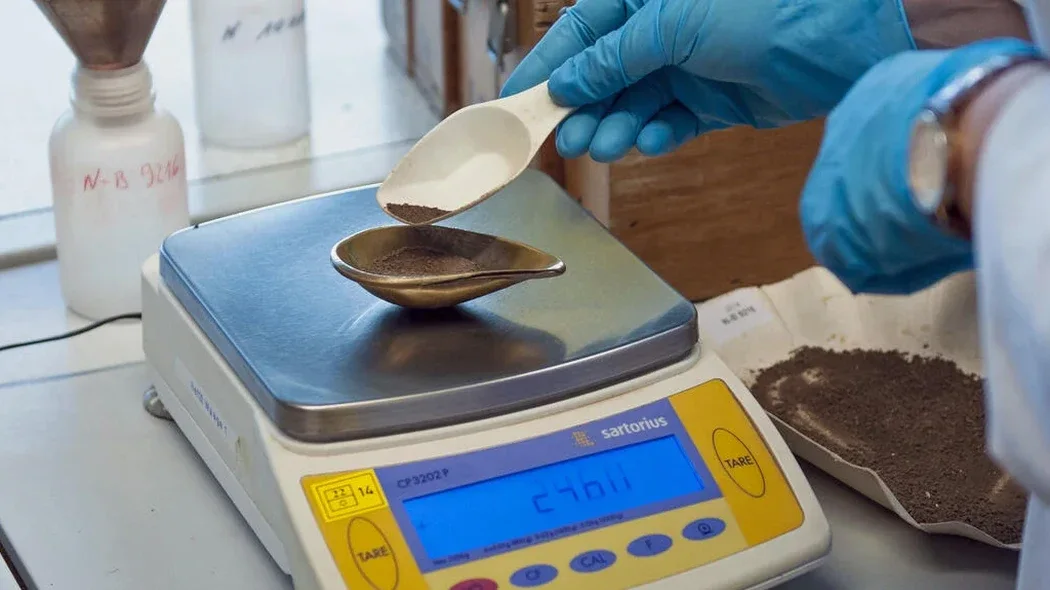
Combined Sieve and Hydrometer Analysis
Complete particle size distribution from coarse gravel to clay colloids using mechanical sieving followed by 24-hour hydrometer sedimentation, with temperature-controlled readings and dispersant correction per ASTM D422/D7928. Includes Cu, Cc, D10-D85 coefficients and USCS classification.
Gradation Verification for Aggregate and Fill
Sieve-only analysis for granular base, concrete aggregate, and engineered fill placed in Saint-Jérôme infrastructure projects, checked against BNQ 2501-025 gradation bands and CSA A23.3 aggregate requirements with rapid turnaround for compaction QC.
Typical parameters
Frequently asked questions
How much does a grain size analysis (sieve + hydrometer) cost in Saint-Jérôme?
A combined sieve and hydrometer analysis on a single sample in the Saint-Jérôme area typically runs between CA$130 and CA$230, depending on whether the material is predominantly granular (faster sieving) or fine-grained (full sedimentation protocol). Volume pricing applies for multi-sample projects, and we always recommend at least three depths per borehole to capture stratigraphic variation.
Why do I need the hydrometer if the soil looks sandy?
In Saint-Jérôme, many soils that appear sandy in the field actually contain 15-30 percent silt and clay from the Champlain Sea deposition. Sieving alone stops at 75 μm and misses that fraction entirely, which controls drainage, frost susceptibility, and seismic site class. The hydrometer extends the curve to 2 μm, giving the true fines content needed for NBCC site classification and pavement design.
How long does the full grain size analysis take?
The mechanical sieving portion can be completed within one working day for granular soils. The hydrometer sedimentation phase requires a minimum 24-hour settling period with timed readings at standard intervals. Including sample preparation, drying, and reporting, a complete combined analysis is typically delivered in 3 to 4 business days from sample receipt.
What sample size do you need for a representative grain size test?
For the combined method we require a minimum of 200 grams of dry material passing the No. 10 sieve for the hydrometer portion, plus sufficient coarse fraction for mechanical sieving — typically 1 to 5 kg total depending on maximum particle size. Samples should be sealed in moisture-tight bags immediately after extraction to preserve in-situ water content, which we measure before oven drying.