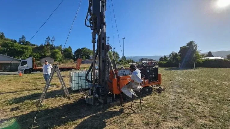
Between the flat terraces near the Rivière du Nord and the sloping till deposits climbing toward Bellefeuille, Saint-Jerome presents two very different soil realities within a single municipality. On the older lots near the cathedral, we often encounter compact glaciofluvial sands that drain well but hide occasional boulder lenses — a legacy of the last deglaciation that shaped the entire Lower Laurentians. Just a few kilometres north, the terrain shifts into silty tills with higher water retention, and that is where an exploratory test pit becomes indispensable before committing to a footing design. Unlike remote sensing or probe-only methods, opening the ground lets us observe stratification, moisture conditions and the presence of organics directly, which is why contractors working on multi-phase projects in Saint-Jerome frequently pair our pit program with a plate load test to correlate visual evidence with bearing capacity numbers.
A well-logged test pit in Saint-Jerome's morainal soils reveals more in 30 minutes than three days of desk-study assumptions.
Process and scope
Site-specific factors
Saint-Jerome's expansion through the 1960s and 1970s pushed residential development onto lands that had previously been marginal agricultural plots or forested moraine ridges, and the geotechnical legacy of that era still surfaces in unexpected ways. Old farm access roads were often built over with minimal subgrade preparation, leaving buried organic layers that decompose and settle differentially over decades — we have documented up to 12 cm of organic silt beneath a 1980s slab in the Lafontaine sector. Skipping a test pit program in these transition zones means risking differential settlement that cracks partition walls and severs plumbing connections, problems that cost far more to remediate than the investigation itself. The other recurring risk involves unrecognised groundwater perched above the till contact, which saturates backfill in spring and can destabilise retaining walls designed without drainage consideration — a scenario we have mitigated on multiple hillside builds by combining pit observations with slope stability analysis early in the design phase.
Watch the video
Reference standards
NBCC 2020 — National Building Code of Canada, CSA A23.3 — Design of Concrete Structures, ASTM D2488 — Visual-Manual Soil Description and Identification, NQ 2501-025 — Fondations (Province of Quebec)
Other technical services
Residential Foundation Assessment
Two to three pits positioned at the footprint corners to confirm bearing stratum, frost protection depth and drainage conditions before the excavation contractor mobilises.
Septic Field Soil Profiling
Deep pits with percolation testing for new installations or replacement leach fields, meeting the requirements of the local environmental health authority.
Hillside Cut-and-Fill Investigation
Pits excavated across the proposed cut-fill transition to identify fill thickness, natural ground line and potential shear surfaces in the underlying till.
Typical parameters
Frequently asked questions
What does an exploratory test pit in Saint-Jerome typically cost?
Budget between CA$630 and CA$1,300 per pit depending on depth, access for the excavator and whether laboratory testing is included. Mobilisation is usually shared across multiple pits, so a three-pit program tends to be more cost-effective per unit than a single isolated excavation.
How long does the municipality take to approve a foundation design based on test pit data?
The Ville de Saint-Jérôme urban planning department generally reviews geotechnical reports within 10 to 15 business days for single-family residential, though timelines can extend during the spring construction rush. Our reports are structured to match the city's submission checklist, which helps avoid back-and-forth requests for missing information.
Can you dig a test pit in winter when the ground is frozen?
Yes, though it requires a heavier excavator with a frost tooth or, in some cases, pre-thawing with a ground heater. The frozen crust in Saint-Jerome typically reaches 1.0 to 1.4 m by February, so winter pits take longer and cost slightly more, but the stratigraphy below the frost line is unaffected and the observations remain valid.
What information does the test pit provide that a borehole does not?
A pit exposes a continuous vertical face, so we can see thin organic seams, cobble lenses, fissures in the till and the true character of the soil structure — features that are easily missed or smeared in a 75 mm borehole. It also allows direct sampling of undisturbed block specimens for strength testing and gives the structural engineer confidence in the bearing surface continuity.